“Amministrare 2.0”
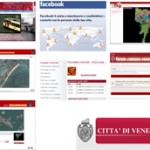
21. June 2009 – 18:41 by Roberto Zarro In 2008, the Municipality of Venezia, in Italy, launched a new project, named “Amministrare 2.0”, with the intention to transform relationships between citizen and the institutions. The idea is to use new technologies to allow a direct access, without intermediation, to information and services designed to solve everyday problems, thanks to the cooperation between citizenship and local government. One year later, we take a look to the services already working and available to reach these ambitious goals
ARGOS (Automatic & Remote GrandCanal Observation System)
ARGOS is a system designed to control navigation in Canal Grande. Several sensors, allocated alongside the canal, monitor position, speed and direction of every boat. ARGOS allows:
- a continuous and real time monitoring of boat’s traffic
- the immediate identification of critical situations (accidents, congestions), and the instantaneous intervention by the Municipality Police
- the detection of violations and illegal behaviours held by boat’s drivers, with a major possibility to contrast them
- a better organization of water traffic, with the consequent reduction of waves in very neuralgic city’s points
IRIS (Internet Reporting Information System)
Iris system, functioning since May 2008, allows to report need of urban maintenance. Citizen can report a problem, showing the place where it is on webmaps or taking pictures of the place and sending it to the website via MMS. In this way, the Municipality can give an immediate feedback, showing on the website the office who has to solve the problem and, at the same time, the progress of the solution’s interventions.
BARIS (Boat Areas Research Information System)
Since October 2008, a new system offer via web all data about occupation of water spaces in Venice and its estuary. The system is based on a cartography owned by the Municipality. Everybody can access to it and consult the map which shows the boats’ footprint and detailed data about concession (except, for privacy reasons, dealers’ names). The map shows all assigned place – at the moment around 8.000 – and indicates with a different colour the about 700 places who are now in insertion’s phase, or under contentious. People can search zooming the map in the points they want to see, using registry number, or the protocol concession number.
Facebook
The Municipality offers and shares its institutional information and data also on the popular social network.
VEdemo
The website of the Municipality’s Council is realized with the software “VEdemo”. It was conceived, designed and realized by the Municipality, is based on a full open-source platform and is inspired by the principles of accessibility, interoperability, usability and re-use. The system allow the e-mail communication to the recipients and real time on line publication of:
- Council’s daily events (works calendar)
- Councilors’ acts (questions, motions, agendas)
- Executive’s official answers
- Acts and initiatives promoted by Council groups and Councilors, and, in the next future, also citizen’s interventions and comments
- activities of the Commissions Board (invitations, reports, minutes, tables present
- activities of district’s Councils (invitations, minutes, activity)
EleGI (Georeferenced Elections on Internet
EleGI is a system of georeferenced cartography. Citizen can use it to obtain information about the elections, from poll’s location to electoral constituency, from results of past elections to link, references and Faq.
Municipality’s Forum
Every citizen, if logged in and respecting the netiquette, can access to the Municipality’s Forum and participate to discussions about city’s life, sending message and proposal.
Click here for more info about the project “Amministrare 2.0”.
Tags: eParticipation, Web2.0


